Friday, February 13, 2015

DERELICTS OF THE COLUMBIA RIVER: DAY 4 - THE LAST AND TOUGHEST

Our campsite at Vista Park sat on a terrace above the Columbia River and offered - yes - a terrific vista. We had breakfast, gathered and packed our gear, and prepared to set out on the Mighty Columbia for the final day of our journey. When we arrived at Vista Park late the previous day, the tide was out and we had a very long shlep from the water across a flat sand beach to the campsite (see photo, below). In the morning, however, the tide was up, and the water was at the base of the concrete stairs leading from the beach to the campground. A much easier launch than we had anticipated.


We set off at 0703 hrs from Vista Park. The weather was cloudy, a slight breeze, and a slight chop on the water. Because we knew the river better than Lewis and Clark had, we crossed to the OR side where the wind and waves were both more moderate. We knew that wind and waves would get progressively worse as we went downstream on the Washington side, and we also wanted to cross the navigation channel sooner. 

Day 4 began at Skamokawa, WA and ended at Astoria, OR.
The Day 4 trip was 17.6 miles of paddling, as calculated from the GPS data afterwards. This was not very much distance, compared to each of the previous three days. We were confident that we would make our destination in Astoria by early afternoon. Little did we know what the day would really be like.

As seen in the photo above, the route we plotted was to cross the river just downstream of Skamokawa and work our way through the numerous low, marshy islands of the lower estuary, an area known as Cathlamet Bay. Our actual GPS track is shown on the map below.
The GPS track of Day 4 starts at Skamokaway, WA at the top right of the image. 
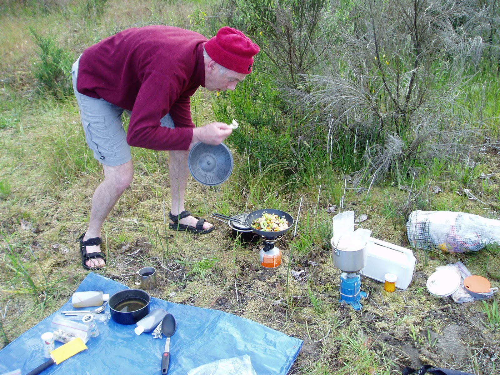
At 0900 hrs, two hours after launching from Skamokaway, we took a 20 minute break on Brush Island (see below). I truly enjoy this part of the Columbia River where one can get lost among the tidal channels and low marshy islands. I wonder how people paddled their way through here before GPS units were available. From Brush Island we worked our way southwest, following a main channel. The tide was falling, which helped us; however, we could tell that a stiff wind was blowing in from the ocean, and we would have to deal with that at some point. 


At one point we tried to speed west across a very shallow area (Grassy Island, above), but the tide was ebbing so quickly we started scraping bottom and nearly got grounded on a sand bar. We quickly back paddled our way off the sand bar and made our way northwest seeking a deeper channel (see the point of our GPS track just below the label "Grassy Island" in the image, above). As we emerged around the north side of Grassy Island we could see our destination, Tongue Point (unlabeled, but above and to the left of Mott Island, image above).

According to my GPS data the distance we paddled from Grassy Island to our landing spot on the lee (east) side of Tongue Point was 3.3 miles, and it took us 1 hour and 15 minutes to make the crossing. That hour and a quarter was the most strenuous paddling so far. The wind was blowing very hard directly into our faces, kicking up a pretty good set of waves. At one point I looked to my left to gauge my speed relative to a landmark on the distant shore - I was paddling as hard as I could and not making any progress! And so I paddled harder. I've been in this kind of situation where you realize that you need to find some way to paddle as hard as possible for a sustained period of time; if you stop to rest for a few seconds you will be blown back to where you started. And so Dry Bag and I paddled our butts off for an hour and a quarter until we got into the lee of Tongue Point, a high, rocky peninsula sticking out into the throat of the Columbia River. 

We carefully pulled and carried our kayaks onto a beach of jagged chunks of basalt rock at about 1245 hrs, found a log to sit on, and devoured as much food as we could get our hands on. We were both exhausted from the final crossing of Cathlamet Bay, and we knew we had a way to go before the day was over. 

At 1335 hrs we launched from the lee side of Tongue Point and headed towards our final destination, Astoria. As we paddled in the calm water of the lee side, I watched a small motorized boat speed out of the bay we were in and around the tip of Tongue Point. The boat was being pummeled by large waves coming upstream. As we watched that boat careening off the top of each successive wave, Dry Bag Dave and I looked at each other with a knowing expression: "we are in deep doo-doo!" (Or something like that.)

As soon as we rounded the tip of the point, we were in the washing machine of wind, waves and tide all colliding in one space. The strategy for paddling in this kind of water is to keep your nose into the waves and paddle like there is no tomorrow. A strong westerly wind was blowing upstream (east) and the waves it produced were at least 3 feet tall and mostly coming straight up-river. I say mostly because some waves were reflecting off Tongue Point and coming crosswise, while others occasionally came at us from the other side. I fell into a rhythm of steady and long paddle strokes, focused on keeping my paddle blade in the water and my nose into the waves, watching the bow of my kayak come off the top of a wave so that 1/3 or more of the boat was in the air, and then plunging into the trough and disappearing below the next wave until it suddenly lifted clear again. Sometimes the nose of the boat would go below water far enough that my waist was almost in the water; this is when a paddler appreciates a drysuit and a well-fitting spray skirt!

I clearly remember to this day the wave that suddenly reared up to my right heading straight for me and slapped me across the face. I didn't see that one coming, but it was very refreshing. What a wild ride, what a fun time, what a lot of work!

We got far enough downstream from the constraining section at Tongue Point that the waves were not as high and had a more regular pattern. The wind was still blowing strong in our faces, and the tide had turned and was flowing in stronger every minute. Our goal was to paddle under the Astoria-Megler Bridge that spans the Columbia River near the downstream end of Astoria; Dry Bag had suggested that this would be a very fitting symbolic ending to our journey. But I could now feel every paddle stroke as a burden, and fatigue had already crept in and filled my old body. We slogged on into the wind and tide until I saw the East Basin dock and ramp, about 2.5 miles from the bridge. I looked over at Dry Bag Dave and shouted to him that I was finished, and I was heading to this first take-out opportunity. He nodded; "Yep - sounds like a great idea," and swung his boat in that direction, too.

We landed at the East Basin ramp at 1530 hrs (330PM), a long eight hours after sliding away from Skamokawa. We phoned our wives, who were already in Astoria at the hotel. They drove to the East Basin ramp and loaded us, our kayaks and our gear onto and into the car; what a terrific support crew they were. We made it; tired, aching, a bit smelly, and with big smiles.

February, 2015, four years and eight months afterwards, I have finally completed the log of the Derelicts of the Columbia River. The trip is still fresh in my mind after almost five years; it was that memorable. Being on the water is one of my very favorite activities; being in my kayak on the water is special because I am so close to the water and I mostly control where I'm going, using my own muscles to do so.  I never tire of studying the ecology of the lower Columbia River as I paddle on it and poke around in its nooks and crannies. It is a complex system driven by wind, ocean tides and flows from upstream waters that are regulated by an extensive system of dams.  Fish and wildlife are abundant and diverse, although not as much as before Europeans altered the system, logged the forests and over-fished and hunted the native fauna. The human history of the river before and after the European invasion is also complex and filled with interesting tales. And of course, the link paddlers have to the paddlers of the Lewis and Clark party adds a layer of wonder and respect for the courage and strength of those people.

If you read this far in this series of posts, I thank you. I wrote this mostly for my own benefit (and Dry Bag Dave's, of course) so I could reread it if and when the memories start to fade. My shoulder is fine now, following the surgery in 2013, and I've been back on the rivers of the Pacific Northwest in my 17 ft wood kayak exploring, day dreaming, getting wet, and doing a lot of smiling.

Paddlin' Paul
February 13, 2015
---


Friday, April 25, 2014

Derelicts on the Columbia: Day 3 - June 15, 2010


It's difficult to put into words the sensation of sliding off a sand beach in a kayak and being grabbed by the force of an ebbing tide of the lower Columbia River at flood stage. One moment you are on solid ground, looking over the smooth surface of water, the next minute you're being swept downstream on the back of a freight train.

It was 755 in the morning when we made the transition from solid to liquid substrate. The sky was cloudy and there was a light drizzle; the wind varied between none and a slight breeze. The water surface was slightly dimpled. In other words, another beautiful day for paddling!

Our destination for Day 3 was Vista Park at Skamokawa, Washington, about 22 miles downstream from Gull Island (see map, below). We paddled for three hours and at 1100AM stopped at one of my favorite spots on the lower river, the seasonal waterfall of Cougar Creek, Washington.

Lower Columbia River, Day 3. Gull Island is under the word "Beach" on the right; the town of Skamokawa and Vista Park are on the upper left. 
Gull Island to Cougar Creek waterfall (Waypoint 018) GPS track; 0755-1100AM. (image 2013 Google)
Time for a short video of the waterfall:


And here is a photo from a previous paddling trip when the river was even higher and we could paddle behind the waterfall:

From the waterfall, Dry Bag and I pointed our bows - well, the bows of our kayaks - downstream once again. Soon the old river town Cathlamet came into view. In his 1906 book, Cathlamet on the Columbia, Thomas Nelson Strong described the town in which he grew up:

Cathlamet, on the Columbia, was, from time immemorial, the center of the Indian strength on the lower river. The Indian lingered longer and the Indian blood is more conspicuous there now than at any other place between Portland and the Ocean. Chinook was a mud beach, a mere fishing station, but Cathlamet was an Indian town before Gray sailed into the river or Lewis and Clark passed by on their way to the sea. Here at the last gathered and passed away the Cathlamets, Wahkiakums, Chinooks and Coweliskies... At its best it was the largest Indian settlement on the Columbia River west of the Cascades, and from the Indian stories must have numbered in the town itself from 500 to 1,000 people. 

Strong was born in 1853, and many of the tales he told in his book were from memories of his childhood, which included talking with native people still living in and around the town. He mentions Queen Sally, of Cathlamet, who was the oldest (about 70) living Indian on the Lower Columbia during the 1850's and early 1860's. Queen Sally remembered the Lewis and Clark expedition that passed through when she was a girl, probably in her early teens.

Today Cathlamet is a pleasant river town. Our first view of town as it glided into view was a series of old docks and floats with associated boats and shacks, most of which were slowly melting into the river.  Yes, derelicts of Cathlamet on the Columbia. I think Dry Bag and I have learned a subliminal message through the years of our paddling together: if you sit idle on the big river it will claim you by rust and rot.


We thought briefly about taking out in Cathlamet and walking into town for lunch; but the river was carrying us, and our destination for the day was foremost in our minds, so we continued downstream.

Just downstream from Cathlamet is a complex of islands called Hunting Islands. The narrow part of the river between these islands and the mainland is known as Elochoman Slough, and the thought of paddling through a smaller waterway protected from the wind and waves was very appealing. We knew the tide was ebbing, and that parts of Elochoman might actually go dry on a low tide, but after quickly consulting the charts and the time, we decided to go for it.

We were wrong! It sure looked like a great idea, but almost halfway through the slough we knew we were in trouble - our hulls were scraping bottom. Now we had to really hurry, because the tide was still dropping and we didn't want to sit in our boats in the middle of a mud flat waiting several hours for the tide to lift us off. So we turned around and headed back upstream towards Cathlamet until we got to the entrance of Elochoman Slough, rounded the corner, and headed back downstream in the mainstem of the Columbia. This failed shortcut cost us an hour!

GPS tracks from Cathlamet downstream to Skamokawa, with a failed shortcut through Elochoman Slough. 

Elochomon Slough, behind Hunting Islands, just downstream of Cathlamet, Washington.  The small numbers are water depth in feet below mean low water. 

We arrived at the Vista Park campground near Skamokawa, Washington by mid-afternoon. We beached the boats on the broad sand beach, unloaded and carried our gear up to a campsite, and then hauled the boats up the stairs from the beach. It was a pleasant day, and we had plenty of time to carefully unpack, do a bit of cleaning up and sorting, and then relax.

Our boats on the beach at Vista Park, viewed from the top of the stairs to the campground.

Relaxing. 

In the back of our minds was a shared goal: burgers and beer at the Duck Inn! We had been on the river for three days, and a hot meal with a cold beer, prepared and served by someone else, sounded like a great idea. At dinner time we walked out of the campground to the highway, across the bridge over Skamokawa Creek, through the main part of town, and into the Duck Inn. The burgers were hot, juicy and delicious; the beer was cold. A perfect meal for the end of Day 3.

A short note about Skamokawa, Washington. The "main part of town" mentioned above consists of a post office/cafe, a paddling company shop, a small inn and a couple of rental houses. Years ago, in my consultant life, I helped a client get permits to redevelop Skamokawa. He had purchased the small cluster of old buildings and some vacant land where the creek and Steamboat Slough meet and then flow into the Columbia. He renovated the old buildings, and built the first two of several planned two-story homes with killer views. The plan didn't work out as envisioned, and the remaining homes were never built, but Skamokawa is a nice place to stop for awhile, or to get away for a few days alongside the big river.

Old Dry Bag Dave and Paddlin' Paul slept well that night, next to the Big River of the West, their muscles a bit tender and their bellies full.

---


Saturday, September 21, 2013

LEWIS AND CLARK ON THE LOWER COLUMBIA RIVER

The Lewis and Clark expedition floated what is now the Portland to Astoria portion of the Columbia River in early November of 1805 on their way to the Pacific Ocean. OK, so they did it 205 years before Dry Bag Dave and Paddlin' Paul did it - big deal! They had a lot of help; we were just two older guys.

The river has changed in many significant ways since 1805 as a result of European settlement and development. There are, however, moments on the river that take me back in time. In very specific locations, usually during winter or early spring when there are very few people recreating on the river, a landscape view and a lack of modern human noises ushers me into history. One of these favorite locations for me is just upstream of Cathlamet, along the Washington shore, where spring runoff creates a seasonal waterfall off a high basalt cliff. If I position my kayak so the waterfall is behind me, my view across the river to the Oregon side has nothing modern in it; no buildings, highway, towers or other signs of civilization. The waterfall sound covers any faint modern background noise. I am transported back in time, seeing the landforms that the Lewis and Clark party saw; a scene that was home for the native people of the river.

Lewis & Clark map, 1805. The mouth of the Willamette
River is at the bottom right of the map, Wapato
Island on the map is the present day Sauvie Island.
Clusters of small triangles indicate villiages of native
people. Downstream is towards the top of the map. 
The Lewis and Clark party left their camp on what is now Government Island on the morning of November 4, 1805 and paddled downstream along the shore of "Wappato Island," now known as Sauvie Island (note that I'll use modern names for places on the river, unless I specifically refer to a name used by Lewis and Clark). They noted 8 villages with about 2,500 residents on the island, and the Indians introduced the travelers to the root of the wapato plant, something Lewis and Clark noted were like potatoes. The expedition also traded with Indians for dogs, which they used for fresh meat. They camped that night on the Washington shore at RM95, across from Wappato Island, near a small bottomland lake now called Post Office Lake in the Ridgefield National Wildlife Refuge. It was not a restful night, as Clark observed in his journal (first draft): "I could not Sleep for the noise kept by the Swans, Geese, white & black brant, Ducks &c. on a opposit base, & Sand hill Crane, they were emensely numerous and their noise horrid."

On November 5 they passed the Lewis River, dined on Deer Island ("crouded with Indians"), and camped downstream from the mouth of the Kalama River near Prescott Beach, on the Oregon side, at about RM71. The expedition camped on a narrow stone beach just downstream of Cape Horn, at RM48 for the night of November 6. The night of November 7 was spent on the Washington side in sight of Pillar Rock, at about RM 27. The men thought they had reached the ocean, and wrote this in their journals. What they really were seeing was the very wide lower estuary and Grays Bay of the Columbia River.

From November 8 until November 25, the expedition was on the Washington side of the lower river, basically trapped on that side by weather and rough water in the estuary. They had some miserable and dangerous times during that period, but worked their way to the ocean. The expedition set up camp at Station Camp, about RM10, just downstream of where the Astoria-Megler Bridge is located today. They used Station Camp for 10 nights. Captain Lewis and 4 men made their way from Station Camp to the Pacific Ocean, and upon their return Captain Clark and 11 men took their turn to the ocean, where they traveled north a short way up the coast.

On the evening of November 24, at Station Camp, the expedition voted on whether to stay on the north (Washington) side or south side for the winter. The south, or Oregon side won, and the expedition went back upriver to their Pillar Rock campsite, where they could safely cross the river to the south side. Once across the river, they camped along the south channel of Cathlamet Bay, between RM19 and 20 for the night of November 26.
Lewis & Clark map, 1805. Tongue Point, lower Columbia River.
Present day Astoria is to the left of Tongue Point; the mouth of
the Columbia River at the Pacific Ocean is to the far left. 

From November 27 until December 6 the expedition camped on the leeward (upstream) side of Tongue Point, RM18. The water around the tip of the point was very rough, as noted in the men's journals. During that period, Captain Lewis and 5 men traveled downstream looking for a winter camp, and the expedition finally moved to their winter quarters at Fort Clatsop on December 7, 1805. They stayed the winter at Fort Clatsop and began the journey back home in March, 1806. The expedition camped in 7 different locations on their way back upriver between Astoria and Portland.

Dry Bag and I made similar distances downriver per day as the Lewis and Clark expedition. We spent our third night at Vista Park, near Skamokawa, Washington, about RM33, approximately 6 miles upstream from the Lewis and Clark camp near Pillar Rock. We knew that the estuary widened below that area, and that trying to cross to the Oregon side further downstream would be difficult and possibly dangerous because of wind and waves. Lewis and Clark had to discover this themselves. So on our fourth morning, Bag and I crossed the river just downstream of Vista Park and entered the wide, island-filled southern part of the Columbia River Estuary.


We fought the falling tide, strong currents and wind for a few hours, finally crossing Cathlamet Bay to the east, or lee side of Tongue Point. I'll write about this grueling crossing in my next post, but we finally made land on Tongue Point and wolfed down our lunch, not far from the site where Lewis and Clark camped for ten nights.

Many things have changed along the lower Columbia River since Lewis and Clark and their companions made their journey. The landscape is different now, and the river itself has been altered by dredging and filling. Even the natural rhythms of the river are different because of upstream dams. But some things have not changed. The 2 daily tidal changes, the wind patterns, the landforms and geology, many of the fish and wildlife are the same as those experienced by the members of the Lewis and Clark expedition. Dry Bag and I know this from experience, and in that way we and the expedition members are brothers.

In fact, Dry Bag Dave is a relative, on his mother's side, of one of the members of the Lewis and Clark expedition, Private Hugh Hall. It is known that Hall had a tendency to drink to excess, and received lashings at least twice for infractions of the rules. Little is known of him after the expedition; however, he might be implicated in one of the great academic mysteries of the expedition. There is some evidence that Hugh Hall kept a journal during the expedition, and this might be the "missing 7th journal" that scholars have theorized about. A story has it that an old journal written by Hugh Hall was passed down in the family, eventually being passed on to Hall's great grandson, John Hall, by John's great aunt. When John Hall was stricken with polio, his mother got possession of the book. and it was destroyed when her home burned to the ground in the great 1961 Bel-Aire fire in Los Angeles.

Fortunately, Dry Bag never drank to excess on our journey, and there was no need for me to give him lashes!

---

Sources:
The Lewis and Clark Journals:  http://lewisandclarkjournals.unl.edu/index.html
Lewis and Clark expedition campsites: http://columbiariverimages.com/Regions/campsites.html
Nautical Chart image:  http://www.charts.noaa.gov/OnLineViewer/PacificCoastViewerTable.shtml


Wednesday, April 24, 2013

Derelicts on the Columbia: Day 2 - June 14, 2010


Day 2. June 14, 2010. Launched from Sand Island at 0730 AM.

The interior of the Superdome in New Orleans has a volume of 125 million cubic feet. The amount of water flowing in the Columbia River during the four days of our great adventure was 500 thousand cubic feet per second, plus or minus. At this flow, called discharge by hydrologists, the Columbia River would fill the Superdome with water in 4.2 minutes.

Dry Bag and I selected the dates for our paddling trip to coincide with high flows in the river, as well as high tides. The lower Columbia River, from Bonneville Dam to the Pacific Ocean, a distance of about 145 miles, has two tidal cycles per day. Our plan was to be on the water every morning at high tide so we could ride the outgoing tide downstream. The river was very high in June of 2010.

To the casual observer on shore, a large river looks fairly placid, especially if the wind is calm and the water surface smooth. Sitting in a kayak, however, is a different perspective altogether. Paddling a river that is at flood stage, meaning that it is overtopping it's banks in places, combined with sets of very high and low tides, is akin to riding on the back of a wild beast. Add a strong wind blowing in your face, with associated waves up to three feet tall, and there are some thrilling moments!

Discharge and Stage at USGS gage, Beaver Depot, Oregon (RM 53.8).
Stage is water surface elevation, and fluctuates twice daily with ocean tides.
We saddled up and pushed our kayaks away from Sand Island at 7:30 in the morning. High tide had been at about 4 AM and was already 2 feet lower. River discharge, the volume of water moving past a fixed point per unit of time, is lowest at high tide and increases as the tide goes out (see the graph). Discharge at high tide  on the  morning of June 14 was about 375,000 cubic feet per second (cfs), and had increased to about 500,000 cfs by the time we launched from Sand Island. Discharge increased from then to about 520,000 cfs; needless to say, we made good time that morning! By about 1030 AM, when we stopped for a break on a beach near Coffin Rock, we had raced downstream about 12 miles, past Goat Island and Sandy Island, in 3 hours. We passed under the Lewis and Clark Bridge between Longview, Washington and Rainier, Oregon at noon, and put in on Lord Island for a lunch break just before 1 PM.


Sand Island downstream to Lord Island


The blue diamond is my GPS point for our lunch spot on Lord Island.


lunching on Lord Island


Gull Island is at river mile 55, and we made our final landfall of the day there just before 5:00PM. We traveled 30 miles down river from our camp on Sand Island, and although it had been a long day of more than 9 hours on the river, we were back on schedule to make Astoria in 4 days.
Gull Island, unlabeled, is near the blue dot in the upper right corner of the image, next to Crims Island.

We camped on Gull Island in a moss-covered meadow above the river. Dry Bag prepared a lovely meal, which we ate with much gusto. We were alone on the island, and the quiet was remarkable, other than the chirping chorus frogs in the nearby woods. I took a short walk on the beach, reveling in the solitude as day turned to dusk. There is very little river traffic this time of year; ocean-going vessels go by in both directions (paddlers need to know where the shipping lane is in the river), and there are a few fisher-persons on the river.

Dry Bag preparing his famous camp meal.
Mmmm...warm goodness, and great with a spork!


Dry Bag Dave at Gull Island

Paddlin' Paul at Gull Island


Gull Island beach solitude

Gull Island moss carpet

Dry Bag crawled into his tent earlier than I did, and I walked away from camp to the edge of the woods and stood for awhile listening to the frogs. I crawled into my tent as the sky was darkening, and slept very deeply after our long day of paddling.

Woods and meadow on Gull Island


Some highlights from Day 2.

Another derelict vessel. In the morning of Day 2 we passed an old derelict vessel that looked like a paddle-wheeler. This was near Goble, Oregon. Here's a video clip.


Coffin Rock (RM 73).  In 1792 Lt. Broughton, sailing with the Captain George Vancouver Expedition, wrote in his log: several canoes covered the top of this islet, in which dead bodies were deposited." He was referring to what is now known as Coffin Rock. Some Northwest coast and Columbia River tribes placed their dead in canoes in special places, such as what we now call Coffin Rock and nearby Coffin Mountain. An account of this practice is here.

Lewis and Clark Bridge between Longview, Washington and Rainier, Oregon (RM 66). This bridge was designed by Joseph Strauss, who also designed the Golden Gate Bridge, and opened to traffic in 1930. At the time of it's opening, it was the longest cantilever bridge at 8,288 ft, and the highest, at 210 ft vertical clearance. When Bag and I paddled under the bridge, we went past one of the two bridge piers that was wrapped because of work being done (I assume it was being sand blasted and painted). At the end of the following video clip you can get a sense of the river velocity by looking at the large steel buoy we passed.


Mayger Fish Station, Oregon (RM 57.5). The fish station was built and opened in around 1910. It had a net shed where fishermen built, repaired and stored their nets, and a station where fish were purchased, packed in ice and shipped to canneries. The river was calm and there was a break in the weather when we stopped there to look and take photos, being careful not to get under this derelict structure. The net shed section, about 300 ft long, collapsed into the river in August, 2012.


---


Monday, April 22, 2013

Derelicts on the Columbia: Day 1 - June 13, 2010


June 13, 2010; 0805 AM. Columbia Slough ramp at Lombard Avenue.

Dry Bag Dave (left) and Paddlin' Paul at the Columbia Slough ramp,
wondering if they really remembered everything.
We pushed off from the muddy base of the small ramp into the murky water of Columbia Slough. Dry Bag and I had planned the trip to take advantage of very large tides in the river and the spring freshet. We hoped to start each day in the early morning on either the high slack or the beginning of the tidal ebb in order to opportunistically hitchhike downstream on the river's flow. Our wives, being the very patient women they are, had gone along with our planning and driven us, our kayaks, and all our gear and supplies to the very out-of-the-way boat ramp not far upstream from the mouth of the WIllamette River in Portland. With hugs, kisses, and a few "good lucks" thrown in, they wished us bon voyage and, being careful not to step into the mud, waved us off on our great adventure.

I had turned 66 years old in April that year, and Dryden D. is six years my junior. We're both in good shape, relatively, and feel very much at home in our kayaks. I don't think either of us had any trepidation about this trip, only a sense of adventure and of doing something we'd both wanted to do for some time. And so we set off down the slough, past a number of strange-looking log structures (fish habitat created by the City), and made a right turn into the Willamette River where we were met by a stiff headwind. We looked at each other and smiled that knowing smile; the Columbia River wind was already blowing.

We've paddled many sections of the lower Columbia River, the section below Bonneville Dam at river mile (RM) 146. (One convention used by people on the river is to reference distance upstream from the river's mouth as river mile. The mouth of the Willamette River, where it flows into the Columbia River, is at RM 101; the city of Astoria, Oregon is at RM 13.) The words "wind" and "Columbia River" are never far apart on a page. The wind blows in from the ocean, or upstream, and often starts around mid-morning and builds quickly. So it was a bit of a surprise that we were already paddling into a stiff wind at about 830 in the morning, but it felt good, and the river carried us.

Sauvie Island in the Columbia River
We paddled on the Oregon side of the river, along the shore of Sauvie Island, one of the largest river islands in the United States (larger than Manhattan!). We spent our first morning racing along the Oregon side of the island, about 15 miles from the mouth of the Willamette to the downstream end. The river was high, as we had planned, from the spring freshet, and the tide was racing downhill towards the ocean. It was an exhilarating and fun ride!

Since I was a boy playing along, and sometimes in, the Chicago River, one of my greatest joys has been exploring and studying nature. Kayaking a river that is seasonally high, and therefore occupying it's floodplain, offers a large menu of such opportunities.

At one point, I saw something in the flooded woodland that caught my attention, and I went to investigate. I immediately called out to Dry Bag to come over. There, nestled into the trees in an area that is usually out of water, was what looked like a UFO!

Upon closer examination, we determined that the UFO was really a derelict vessel, the SS Kbar, that must have been carried into the woods during a flood event and remains there to this day. Sometime after our trip I searched the internet and found photos and discussions about the Kbar by people who had hiked through the woods to view it. All I can say is - what the...?


We moved on from the SS Kbar, and at a point perhaps half-way along the island shore, I took advantage of an opportunity to paddle through the flooded floodplain woodland that had a foot or so of water over it. Dry Bag decided to stay in the channel just outside the trees, and we caught glimpses of each other as we kept pace. I poked around, mindful not to get too far behind Dry Bag, looking at the vegetation, listening for birds, watching for signs of fish. After some distance, I headed back to the channel through the trees. Ahead of me, anchored just offshore, was a group of very nice small yachts; I wondered what the occasion was. As I cleared the trees, the shore opened up to a beach area, and I was between the anchored boats and the shore. There, on the beach, was a fairly large group of people age 60+ - all stark naked! They were playing games, sitting in beach chairs, drinking, talking, and waving at me! OK...a bit awkward, but I smiled, nodded my head in their direction, and paddled on. (Sorry, no pix.)

The downstream end of Sauvie Island is known as Warrior Point. A short distance upstream from the point is Warrior Rock, on which sits the Warrior Rock lighthouse, a rather unimpressive structure that has stood since the 1930's. (Note 1) I made a mental note of the time as we paddled past the lighthouse, about 1 o'clock in the afternoon. We had made our way along the length of Sauvie Island, about 15 miles from the Willamette River mouth to Warrior Point, in 5 hours. Our target for the first day was Goat Island at river mile 80, within reach if we kept up our pace of about 3 miles per hour. But the Columbia River has it's own ideas, a truism learned only by experience.

As we passed Warrior Rock, the river channel changed direction by about 30 degrees to the west, and we were suddenly straining at our paddles into a strong westerly wind and large swells. This is a typical pattern on the lower Columbia, and combined with a very strong ebbing tide the river was suddenly a living thing upon whose bucking back we were riding. Ahead of us on the left, the Oregon shore, lay the town of St. Helens.

We crossed the open water between Warrior Point and St. Helens, a distance of about 2 miles, in a state of intense concentration. The current was so strong that we could have easily been swept past the town. The strong head wind and big swells challenged our skills on what would be a leisurely paddle on many other days. We were using every ounce of strength and every nuance of paddling skill to make the crossing.

There is a large marina in St. Helens, and we planned to hold up at one of the outer docks to rest a bit and decide how to proceed. The marina raced towards us (a paddler's perspective about moving and stationary objects is different from that of land lubbers). Dry Bag was ahead of me, and he grabbed hold of a dock cleat. I was on a course to get to the dock just downstream of Dry Bag, and I shouted something to him as I raced by, wondering what the funny look on his face was about. I immediately understood his expression when I turned my gaze to the front and saw the next dock, one that sticks out perpendicular to the flow, racing towards me at a very high speed (there's that paddlers perspective again). My gaze lingered on the roiling interface of water and lumber where the mighty river crashed into and slid under the dock. Uh-oh.

An experienced paddler has synapses that are lacking in the nervous systems of non-paddlers. My upper body immediately switched gear into a back-paddle, with subtle movements that pointed the stern of the kayak away from shore, executing what we call a back-ferry that moved the boat sideways towards the middle of the channel. As I raced past the end of the dock, I took a quick glance over my shoulder and saw that Dry Bag had also headed out into the channel. We were back into the belly of the beast, and could tell that the wind was gathering more strength and the swells were getting higher. We had a short shouted discussion about our situation, and agreed that Goat Island was now not within easy reach.

Sand Island sits in the river across from St. Helens, and solid ground under our butts felt awfully good once we had pulled our boats up the shore and sat for a brief rest. The island has picnic and camping facilities, including a small building with bathrooms. It is a popular spot during summer, but this was early June, and the weather was still chilly and rainy, so we had the island almost to ourselves. We scouted out a good camp spot, hauled the boats and gear up from the river, set up our tents and camp kitchen, and settled in for the evening. We both felt good, but we both knew that making only 15 miles on the first day was a major problem.
St. Helens, Oregon on the left; Sand Island on the right. Our route is shown in blue (GPS track).
Map Data 2013 (c) Google


It was mid-afternoon when we finished setting up our camp, and the weather was very pleasant - cool and partly-cloudy. We explored the island, on foot of course. Most of the island is wooded with typical bottomland trees, mostly black cottonwood, and shrubs. Like most Columbia River islands, Sand Island is an elongated oval with the long axis parallel with the river channel. A long sand beach occupies the northern side, perfect for walking, looking at the river, and finding interesting bits of stranded debris. The south side of the island faces the town of St. Helens, and this, too, was a pleasant view in the changing light of the horizon rising to meet the sun.

The chilling air and time of day made us realize that we were really hungry; we had stopped once from about 11:00 to 11:30 in the morning for a pee break and a snack. And so I started to assemble the evening meal, a simple menu of corned beef and potato pancakes. These were left-overs from a party a few days previous, and once the food was heated on the little camp stoves, it was truly a fine hot meal.


We crawled into our tents at some point after dinner, and both slept like old, worn drift logs stranded on a high beach.


---
Notes:
(1) How Warrior Rock got it's name: On October 28, 1792, an advance party from Captain George Vancouver's Columbia River expedition set foot on a rocky point at the north end of Sauvie Island. Shortly thereafter, Lieutenant William Broughton and his men were surrounded by twenty-three canoes carrying war-clad Chinooks. Broughton prudently decided to make peace rather than fight and called the place "Warrior Rock."   The original lighthouse and bell structure was built in 1889. The entire history is told here

Derelicts on the Columbia: Introduction


My right shoulder is mostly feeling ok, and I "graduated" from physical therapy a couple of weeks ago. Every medical person who has reviewed the file on my rotator cuff surgery has exclaimed, with raised eyebrows, something like "wow, they did a lot of work in there!" I've suffered quietly with bad shoulders for a number of years, but it was the Derelicts on the Columbia River trip of 2010 that did me in.

Dry Bag Dave, or sometimes Dryden. D. "Drybag" Dave, is my paddling buddy. Paddlin' Paul is my on-water moniker for our adventures. We had talked for many years about paddling the Columbia River from Portland downriver to Astoria, near the river's mouth, a distance of about 90 miles. One day in early 2010 Dry Bag mentioned that he was thinking seriously about paddling from Portland to Astoria that spring. I informed Dry Bag that he surely wasn't going to do such a trip alone, and that, after all, we had been talking about it for years. And so we began to plan together.


the lower Columbia River, Portland to Astoria, Oregon
Map Data 2013 (c) Google

Overview of Columbia River from Portlsnd, Oregon to the Pacific Ocean. The flag "COLUMBIASL" is the starting location for the trip (Columbia Slough ramp) near the mouth of the Willamette River. Other flags are waypoints entered into my GPS along the way (see other posts). In this image, north is to the right, west is at the top. The Columbia River flows north/northwest from Portland until it turns westward (past SANDY ISLA in the image).
screenshot of Google Earth image
(c) 2013 Google
Image (c) 2013 TerraMetrics